Great Walk 2012 Carnarvon Gorge by John and Yasmine Vriesekolk.
For a wile we’ve been planning to go to Fraser Island to do he Great Walk. Bought a topographic map, food for 11 days on the track and planned where to start and finish. The Friday before our departure I rang the Ranger and he told me that there were closed parts of the Great Walk due to bushfires, flooding and other damages. We had to change our travel plans. Bye, bye Fraser Island, hello Carnarvon Gorge where a 87km, 6 days walk was waiting for us. I bought a topographic map of the walk at the same time as the Fraser one, for future references. From Brisbane we drove via Toowoomba, Roma and Injune to the beautiful Carnarvon Gorge. In Roma we had a lunch break at The Queens Arms hotel. Great tasting food although a bit heavy on oils (and stomach). When we left home, the weather didn’t look too bad but at Toowoomba the showers started to come down on us. Between Injune and Rolleston a road to the left leads to Carnarvon Gorge. The last 15 km is dirt road and because of the wet weather we had lately, the road was very slippery and mud started to decorate all sides of the car. Kangaroos, wallabies, cows and the odd Bustard (bird) were a bit of a worry but they slowly moved over to let us go past. Qld Government warned that the road can become impassable after heavy rain and recommends to use the road for conventional vehicles only in dry weather.

Takarakka Bush Resort
We parked the car at the Takarakka bush resort where we had booked an unpowered site for $ 35.00 a night. The attendant showed us where to set up our tent but we were back very quick because he directed us to a powered site which already was taken. Little mistake and after going to the right spot we set up camp at the correct site. A small group walked in. They had walked the Great Walk and did so in the rain for the last two days. Not very promising. I said to the attendant that I ordered sunshine when I booked the site and he said: “I’ll do my best”.
A large coach was parked on the resort and during our inspection round (which you do when arriving at a campnig) we discovered that it was from a company close to our suburb and had a lot of American students on board to tour Australia.
The first day hiking. 10km without side tracks.
At home, most of our needs on the track were already packed in our backpacks and after having the tent and sleeping bags added to the weight we parked the car nearby the visitors centre of the Gorge and went inside where a Ranger was very helpful in explaining what to expect on the track. A steep climb, showing us escape routes in case we run into some trouble and that it will be cold on the thirth and fourth campsite. Not being put off by this, we registered with the Ranger so he knows who’s on the track and when we expect to return. Camp sites have to be booked, which can be done online.
The Takarakka attendant had done his magic trick. The weather was great. Blue skies over our heads and full of energy we started to follow the signs.

Carnarvon Creek
The first challenge to overcome was a crossing over the Carnarvon Creek although, there are big rocks in the creek to step on and compared to what was coming, this was not a challenge at all. There are several side tracks like the Moss Garden, the Amphitheatre (temporary closed), Ward’s Canyon, the Art Gallery and Cathedral Cave. All of them well worth a visit.

Moss Garden
To reach the Art gallery (the last side track) we had to cross the creek 18 times. After 15 crossings without getting our feet wet, at the 16th we were not so lucky. The water level was high and I slipped of a rock and landed with both feet in the water but, managed to stay upright, just. The in and outside of my hikers were completely drenched. Yasmine got one foot wet. To reach the Big Bend camp side we had to cross the creek two more times.
Big Bend is a nice flat camping area next to the Creek, with place for several tents and a picnic table. Water is available and there is a toilet a bit far from the tent site. Currawongs (the birds) are a nuisance. They are constantly around waiting for the right time to steal some food.
Day Two 14.8km.
A cool morning but blue skies again. Ideal weather for hiking. We had to retrace our steps (two creek crossings) and then turn right into Boowinda Gorge.

Boowinda Gorge
Lots of big pebbles but not too hard to walk over. To get out of the Gorge, after about 1 km, a very, very steep climb had to be overcome. In the bottom boulder some steps were made to get a start and from thereon I had to give Yasmine every now and than a push while she had to pull me up on my backpack to keep my balance. After this climb, the track kept going up and some manmade steel stairs were a good help to reach the top. On this part of the track beautiful views of the Gorge are unfolding.

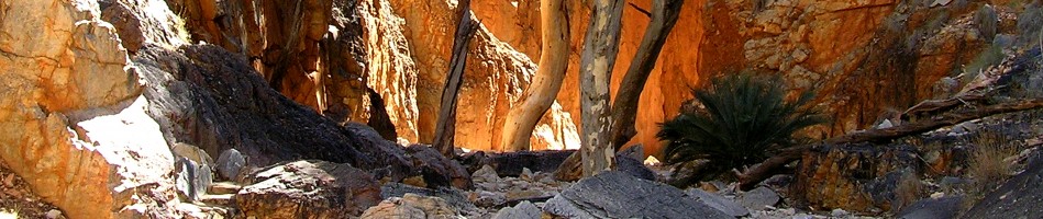
Carnarvon Gorge
This climbing took us a long time and we were running late. It was dark when we reached Gadd’s walkers camp. A nice campsite with a shelter, water and toilet. We could set up the tent under the shelter but were asked by the ranger not to use the pins for our tent to not disturb the soil or damaging the underlying water tanks.
Day Three 15.8km.
Still wet shoes and blisters were starting to form. The track was easy to follow. A lot of back burning had been done. At times the track was wet, muddy and slippery, other times nice and dry. Just before the West Branch walkers camp a hanging bridge helped us to cross the West Branch of the Maranoa river the easy way.

Hanging Bridge at West Branch Camping site
At this spot there is a walkers camp (we only saw a tap) and a large camping area. We walked to the campsite and pitched our tent on a nice spot. We heard a koala calling for a mate overnight and the night was cold, very cold.
Day Four 17.3km.
In the morning Yasmine had a hard time to open the zipper of the tent. It was frozen. Ice was on the tent. The ranger had told us that the third and fourth campsites were freezing cold. He was right about the third one. After a concert from the local bird band (lots of lorikeets) we packed up. We have a routine in the morning. Yasmine cooks breakfast, boils water to fill up the themosflask for morning tea and lunch (we eat our dried food midday as dinner) and I pack the sleeping bags etc. and break up the tent. We went back over the hanging bridge and then left to follow the track towards the Consuelo Camping zone. The views along the track were nice. The track went again up from about 800m to 1000m, evens out and then further rise to about 1200m. We still had nice weather.

Consuelo Campsite
The Consuelo camp had the same setup as Gadd’s walkers camp. A nice shelter to catch the rain water. Two water pumps, water but no toilet. We were having our dinner when two emu’s came from the woods to forage around the campsite. They didn’t seem to be too nervous about having two visitors in their area. The sunset coloured the clouds red and when we snuggled up in our sleeping bags it started to rain.
Day Five 13.8km.
It had rained overnight but it had stopped in the morning. We didn’t see a lot of the world around us after opening the tent. A thick fog was having a strong grip on the Gorge. We stayed a bit longer in our home away from home. Not a long walk today and a fairly flat one too so, time enough to get to our next destination.

Fog in the Morning
The mist had a nice effect although we didn’t have nice views because of that. The spots where we normally take a break (fallen trees or big rocks) were too wet and here too a lot of back burning had taken place and blackened everything. Some tree trunks still had smoke coming out of them. We decided to only have one coffee break and walking through to the next camp which was Cabbage Tree camping zone where we had lunch, a nice relaxed afternoon and dinner later on. Again a wonderful shelter so a nice dry place to set up our tent. Water but no toilet. The blisters were hurting a bit.
Day Six 15.3km.
Early up, we didn’t want to be too late back at Takarakka bush resort and we also would like to see the Ranger as well. Still a bit misty but dry. Since we did a lot of climbing, now on the last day it went down.

Where is the Track
Some parts of the track were overgrown and hard to find but the arrows on the trees showed us the way. From the track nice views towards The Devils Signpost (Mountain) and wide views over the landscape can be enjoyed. The Great Walk Track and a track towards Boolimba Bluff lookout come together. The last bit is marked with ladders and steep steps before joining the track that brought us back to the visitors centre. The Ranger was on patrol and we met a couple that were friendly enough to take a picture of the adventurers. Between the visitors centre and Takarakka is the Carnarvon Gorge Wilderness Lodge where we enjoyed a coffee and booked a table for the night at their restaurant. Lateron we heard that we were very, very lucky. The weather had been very bad and the tracks were closed for two days. We had only rain on one night and didn’t have to walk in the rain.
Some walkers notes:
Water should be treated before drinking.
No rubbish bins along the track. Take out what you take in.
Topographic map from Qld Gov online bookshop: https://www.bookshop.qld.gov.au/ProdSearch.aspx
Great Walk Campsites booking at: https://www.derm.qld.gov.au/parks/iaparks/gds/IAGDS450.jsp?newGWId=19
Takarakka Bush resort: http://www.takaru.com.au/takaru/splashpage.cfm
Carnarvon Gorge Wilderness Lodge: http://www.carnarvon-gorge.com/default.htm
More images by John here: http://johnsart.redbubble.com/


